Thursday, February 17, 2011

Perrito Moreno Glacier

After leaving El Chalten we finished our journey down Ruta 40 to the town of El Calafate. The town is named for a berry that grows in Patagonia (seen in the picture below). Legend has it that if you eat some of these berries, you will one day return to Patagonia so we had to eat a few. They were actually not bad and had a flavor kind of like blueberries!

The town of El Calafate itself is not all that spectacular, but it is still a huge tourist town because it serves as a base (with an airport) to travel to a lot of attractions in southern Patagonia. We used it to hit 2 of the most famous: Torres del Paine (details coming in our next post) and the Perrito Moreno glacier.

The glacier is one of the most accessible in the world and is also one of the only glaciers that still advances and retreats seasonally and is not losing mass overall. The glacier is not as old as many in Europe or other places because it flows quite quickly, by glacial standards, due to the slope of the ground it flows down. The ice in the glacier is only a few hundred years old compared to a few thousand or even a few hundred thousand for other glaciers around the world. The young age of the glacier clearly didn't take away from it's beauty which we first observed from the maze of observation decks near the glacier. Unfortunately we didn't get to see any large pieces break off and fall into the water (called "calving") while walking around the decks.

The accessibility of the glacier gave us the unique opportunity to join a tour, strap on some crampons, and walk on the glacier, So we hopped onto a boat (like the one in the picture below) and crossed the lake to go for our adventure. We first walked along the south edge of the glacier for about an hour and a half before stopping to put the crampons on and hit the ice.

Jenna was clearly very excited by this opportunity...

We walked for about 4 hours out on the glacier and unfortunately it got a bit rainy and overcast so I wasn't able to take too many pictures but it was a really fun experience. I kind of want to go buy some crampons for recreational use!

Near the end of the hike the guides planted their crampons near the edge of a moulin (sort of a hole in the glacier caused by warm melted water flowing downward) and let us take a look over while hanging on to our climbing harnesses so we didn't plummet to our deaths. The picture doesn't quite do the moulin justice but you get the idea.

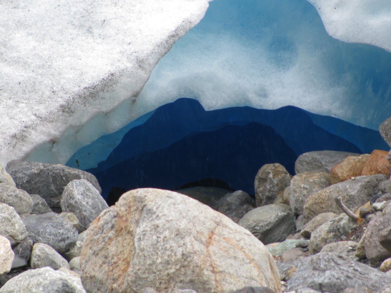
Being the science nerd that I am, I couldn't help being fascinated by the glacier overall. I had expected the surface to be much smoother than it turned out to be (I guess this was my expectation having grown up playing on ice in Wisconsin which is very smooth and slippery) but it was actually quite rough from all the small areas of melted water that had formed, frozen, reformed, refrozen, etc. You can kind of see this from the pictures of the crampons above. The most interesting thing however was the color of the ice. Due to the immense weight of the ice, air bubbles are squeezed out of the buried ice. This gives the glacial ice a different color than normal ice from your freezer since the lack of air bubbles makes the light refract differently as it passes through. The fewer air bubbles in the ice, the deeper blue it looks as you can see from the pictures of the crevasse and hole below.

On our way back out to the boat we got to see the other tour group (that only got a short walk on the glacier) and got a little perspective on how immense the glacier is.

The tour company had one final surprise for us on the boat ride back... whiskey with glacier ice in it! Cheers to a fun day!

See the banner at the top of the blog for a panoramic shot of the glacier.

Sunday, February 13, 2011

El Chalten

The town of El Chalten was founded in 1985, when Argentina and Chile were fighting over land. The year round population is around 600, and the ATM is less than a year old. It is also known as the hiking capital of Argentina because of the Fitz Roy range in the Parque Nacional Los Glaciares (Glacier National Park). The park has quite a few glaciers and is divided into two sections, the northern section, and the southern. While we were in El Chalten, we were hiking in the northern part.

The great part about the town is that the trail heads for the hikes start from town. No need to drive or hike a long ways to get to where the trail starts. We did two hikes total in El Chalten, camped up on a mountain in a the park, were stuck in our tent for almost two days straight with rain and wind, almost were knocked off bridges trying to get back to our tent with the 70+ mph winds, but had some amazing views! The first hike we did was about 8 hours, with 2 1/2 hours of ascent of 800 meters.
Along the trail we saw one of the glaciers... it just seemed to pop out of nowhere!
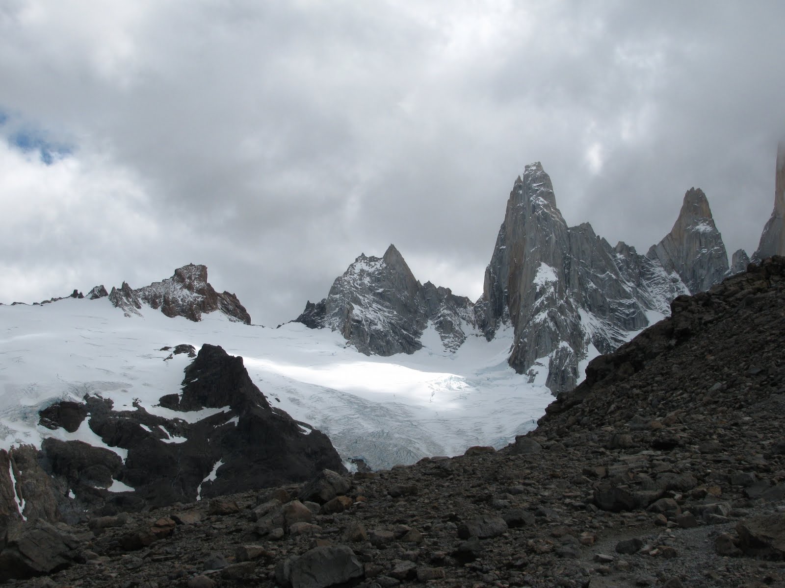
Then we started to see where we were going... Cerro Torre and Cerro Fitz Roy. This is only part of the range... Cerro Torre eluded us the whole time we were there. The clouds just would not depart!
At the top of the hike, were two glacier fed lakes, Laguna de los Tres and Laguna Sucia (literally dirty lake; the water was green from the glacier melt). It was the best tasting water I've ever had, and after a difficult ascent, it was amazingly peaceful.
The view of the valley and how far we'd come was breathtaking!
A beautiful mountain peak and more lakes from our second hike.
The peaks we were trying to see the whole time we were there. Finally, on our last day, the clouds lifted a bit so we could see them. We couldn't finish our second hike due to weather (rain and the crazy wind).

I have never experienced such extreme weather conditions like there were on the trails and in the campground in El Chalten. Even with the cloud cover and awful weather, the views were still spectacular. I can't imagine how beautiful and breathtaking it would be on a clear day.

Thursday, February 10, 2011

Cueva de Las Manos

On the morning of day 2 of our journey down the Ruta 40 we had the option of getting up a bit early and taking a little detour to see the Cave of the Hands an hour outside of our overnight bus stop in Perrito Moreno. I have some recollection of having read about and seen pictures of this cave a long time ago in a magazine like National Geographic and was therefore very excited to see it and was able to talk the other 4 members of the group into coming with me. We hopped into a van and headed down the road to the private ranch where the cave is located. Along the way we saw lots of guanacos, a few things that were either giant chinchillas (which live in the area) or some large rabbits, and some rheas. The picture below shows how similar these cousins of ostriches are to the ostriches themselves.


The Cave of the Hands itself is not so much a cave, but rather a series of overhangs and indentations along a cliff that forms one side of a canyon. You can see the path we were going to take from this picture looking across the canyon. The hands and other paintings are actually located along the cliff just above the path.

We hiked down across the canyon and river to the visitor's center and then on toward the paintings. The first paintings that we came to were the oldest which have been radio-carbon dated to around 9,000 years ago. This makes these paintings extra interesting because they represent some of the earliest evidence of people inhabiting the southern part of South America. While scientists disagree on when exactly the earliest inhabitants of these areas arrived, even the earliest estimates for human arrival place the people who made these paintings among the earliest to arrive here.

The oldest paintings are the negative images of hands. They were made, archaeologists guess anyway, by the people crushing specific minerals like hematite into a fine powder, mixing them with some sort of adhesive, putting this mixture into their mouth, and then blowing it through a hollow tube (quite probably a hollow bone from a bird) over their hand which was held up against the rock wall.

The deer-like or cow-like images you see are of guanacos, the smaller cousin of the llama, which made up a large portion of the diet of the first people. The larger ones were thought to represent adults and the smaller ones juveniles. This represents a step forward in the art abilities of the people. Also in this picture you can see a white circle thought to represent the full moon. This scene when interpreted overall represents how the guanacos are said to give birth when there is a full moon which people still believe in the area.

The black lines you see under the black guanaco here are not just racing stripes; they represent bolas which are essentially rocks tied to the end of strings that were used to hunt the guanacos. You can also see on the right side of this picture some human stick figures with lots of black dots seeming to go up from them which represent people throwing bolas or spears while hunting guanacos. There were several other hunting scenes depicted on the wall which show that people were trying to record their everyday lives in their paintings.

The art continued to evolve over time to include more abstract shapes and things such as this lizard,
this thing which I think was supposed to be a scorpion (can't remember for sure),
a spiral, a more stylized person, and this other figure that looks like 2 arms reaching for a bar of some kind.

Here we can see how even the painting of the hands evolved over time. There are negative images of the feet of rhea in this section of wall! There are also contrasting color hands where the people painted the wall one color and then held their hand over it and blew a different color paint over the top.

There are handprints from men, women and children located along the wall but nearly all of them are of the left hand. It appears that even back then most people were right-handed. There is even a 6-fingered hand!

I was personally fascinated by this place and how such simple pieces of art could endure for 9,000 years on the side of a cliff. The extremely dry air and lack of rain or direct sunlight have preserved an open-air museum that definitely merits a stop if you are ever passing down the Ruta!

Tuesday, February 8, 2011

Ruta 40

Part of the adventure of traveling is figuring out how to get from Point A to Point B. On our latest vacation, it involved the Ruta 40. It has been said that it is one of the world's greatest, yet most desolate stretches of road. It is Argentina's longest road; 3,107 miles long, passing through 11 provinces, 18 rivers, and only half of it is paved. Outside of South American travel gurus and Che Guevara fans, most people have never heard of it.

It is desolate. And it is windy. Really, really windy. The yellow landscape you see below is what we saw, almost all we saw, for two 12-hour days riding on a bus. Oh, and we did see some guanacos (same family as the llama) every once in a while.
This was close to the end of Day 1, when the pavement ended, and the dirt road began. The bus company we went with divided the trip into two days, with a night spent in a small, incredibly windy town called Perito Moreno. The town was ridiculously small; we were wondering what in the world the people who live there could possibly do for a living. Almost all of day two was on gravel, with a dusty bus, whose windows were not exactly sealed well, without a bathroom in the back. Some of the "bathroom stops" did not actually involve bathrooms but a few bushes and trees to block the wind.

It was two days of seeing a lot of the same (we also did a tour the morning of day 2, which Jesse will talk about in a later post). The Ruta made me appreciative for the modern highway systems of North America, but at the same time, a bit nostalgic for all the adventure left behind when we modernize, change, and transform classic, ancient journeys and turn them into efficient, tourist machines. I'd like to go back 40 years and travel along la cuarenta back then; it must have been the most desolate stretch of road imaginable, the type of road that makes you do a little soul-searching.

If you would like more information on the ruta 40, the following websites have some info.
The first link has one journalist's trip along la cuarenta, although he did not travel the same section that we did. His journey was a little bit easier!
http://www.travelandleisure.com/articles/andean-highs
And if you are interested in factual information, wikipedia site
http://en.wikipedia.org/wiki/National_Route_40_%28Argentina%29
Finally, one last person's experience on the road; he writes a bit more eloquently than I.
http://www.brendansadventures.com/ruta-che/

Sunday, February 6, 2011

Bariloche, Argentina

Due to all the travel issues we had over Christmas, our vacation plans changed a bit. We were planning on having two days in Bariloche, but since we weren't going to northern Chile or the Salt Flats, we decided to spend a few more days in Bariloche. Bariloche is right along the Andes mountains, next to Nahuel Huapi Lake.
The main, government buildings downtown were all designed in the 1930's with a Swiss-German architecture feel.

We rode the teleferico (gondola) up the side of the mountain to get a good view of the city.
Bariloche is known throughout South America as having good chocolate. I mean, chocolate shops were everywhere! We asked a taxi driver for his favorite place, and he said Mamuschka. So we went there. Twice. The bonbones (filled chocolates) were amazing. I wasn't all that impressed with the plain chocolate, but the ones filled with dulce de leche, mousse, coffee, almonds; they were amazing.
We went on one day hike before our friend Amy and her sister and brother-in-law arrived. It was an 8 hour hike, around 20 kilometers, with about almost 2 hours of ascent on the Cerro Catedral. The Cerro is the main ski mountain for the area in the winter. The hike was difficult, and this being our first hike in awhile made it even more difficult. For the last 20 minutes we were climbing over boulders. Our knees and feet were killing us by the time we got back, but, there were some beautiful views that you just couldn't get from anywhere else.
There was a whole area of burnt trees, from a forest fire, and they led themselves to some beautiful photos.
What was interesting about this hike also were the rock formations of the mountains.
This was the refuge at the top of the hike. If we had wanted, we could have brought up our tent and spent the night there.

We went on one other small day hike when our travel buddies arrived. This one was in the national park, by all these small lakes and lagoons.
On our last night in Bariloche, we went out to eat, at this hobbit house looking restaurant, completely built with local, Patagonian wood. I wish I would have brought my camera to take a picture of our meal. It was probably the best steak and lamb I've ever had. And the dessert, the chocolate spell,... well, it was devoured in minutes!

Tuesday, January 4, 2011

Travel Woes

Sometimes, the travel gods look down on weary travelers and give them flights that leave on time, upgrades, and friendly personnel. Sometimes, I think the travel gods look at some people that travel a lot and say, hmm... I'm a little bored, they haven't had too many travel snafus, let's see what I can do!

Our travel plans over the last few weeks have been so crazy, its a miracle that Jesse and I are still together! First, on our way back to the U.S. to visit family for Christmas, our flights leaving Asuncion and Montevideo were delayed, so we arrived 30 minutes before our flight to Miami. That was not enough time for LAN airlines, who had overbooked the flight and gave our seats away. This led to about two hours of arguing with both Pluna airlines and LAN to discuss who was at fault and who would get us on a new flight. We had to spend a night in the Santiago airport and then were put on an American Airlines flight back to the U.S. the next night.

Now, normally, that would be enough for some people. Not for us. On our way back to Asuncion, our flight out of Dallas to Santiago was delayed. No big deal for us; we had a big enough layover in Santiago. However, our luggage never made it to Pluna airlines and our connecting flights to Montevideo and Asuncion. We had one extra day in Asuncion, so we thought, yeah our stuff will make it in time before we have to leave for our vacation. Nope, it didn't. American never gave our stuff to Pluna; our luggage was sitting in the Santiago airport for three days, before American finally released the bags not to Pluna, but to Tam airlines. We learned this after our fourth call to American Airlines. We were not notified when they arrived in Asuncion.

So, we were supposed to fly back to Chile, go up to the northern part and visit the Atacama Desert and the Salt Falts in Bolivia with some friends. When our luggage was continually delayed, we told Pluna airlines that if they could change our flights and just get us to Bariloche, Argentina on the 4th, we just wouldn't go to northern Chile, we would cancel that part of our vacation, and everything will work wonders. Well, we are leaving tomorrow, the 5th, after more than 10 calls to the Pluna personnel, four trips to the airport, and one trip to the Pluna offices.

To add insult to injury, we got stuck in a rainstorm on our way out to the airport for the fourth time. We have a motorcycle.

To add a second insult to injury, when we finally got our stuff, we discovered the Chilean customs people had gone through our stuff (even though we never went through customs). They took and destroyed my 3lb. bag of craisins, some crushed red pepper, and a can of shaving cream. Really?? That's what you take and destroy?

I hope this is the last issue we have for a while......

Sunday, January 2, 2011

We're Engaged!

On Christmas Eve, Jesse proposed! We haven't figured out any wedding details yet, but since I didn't get to show off my ring to too many people when we were home, here's a few pics of it!