Wednesday, April 21, 2010

Punta del Este

I realize that I haven't posted in awhile about the final destination for our Semana Santa trip. Its been a busy few weeks! So here's a brief snapshot of our three days in Punta.
First, I'll preface by saying that Punta is the place where a lot of our students go for the summer, and its the "it" place to be seen by Argentines, Paraguayans, and Brazilians. So we thought we have to go there once and at least see what everyone has been talking about. Quite honestly, it was an okay beach with a lot of people! It was our least favorite part of the trip. We did play some paddle ball on the beach, laid out in the sun, ate some good steak, and went for a nice bike ride.
Here is a view of Punta- notice all the high rise buildings along the white sand beach?
Here is a view of the rocky side of the peninsula.

Finally, us in front of the "hand." There was a famous artist who built this structure on the beach here and its a famous landmark in Uruguay. Our hotel was about two blocks from here, which was incredibly nice to be so close to the beach.

Tuesday, April 6, 2010

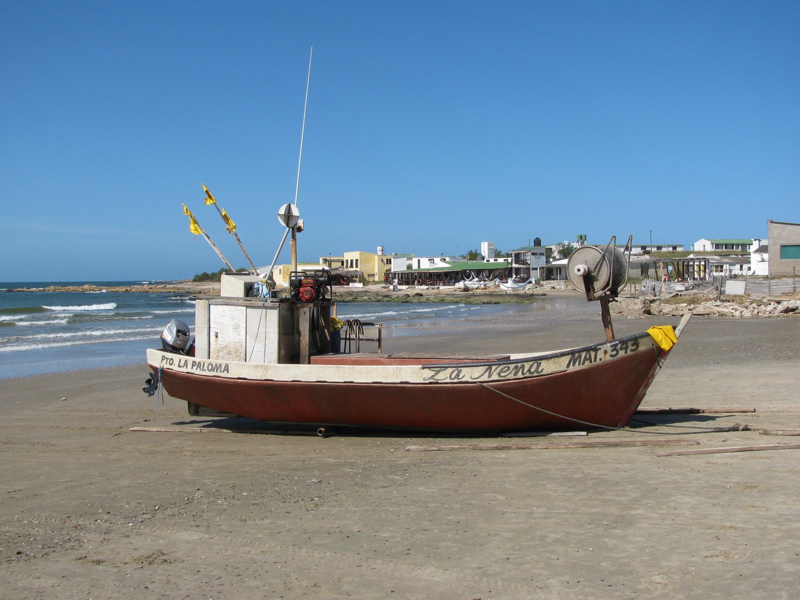
Monte de Ombues and La Paloma, Uruguay

After Cabo, we went to a went to a national park with a population of the national plant/tree the ombues. Biologists don't know exactly how to classify the plant, because its huge like a tree, but doesn't grow like a tree, it grows like a bush. Anyway, they were pretty cool and along the way there we saw some amazing waterfowl.
After the park, we went to La Paloma which is known for its surfing. Jess and I had tried surfing two years ago in Costa Rica, and he wanted to try it again. He needs more practice!
La Paloma was a very chill beach town, but one thing that was cool was that they had a whale skeleton in the center of town. Here, Flat Tristan (my cousin's flat person who took the trip with us) had his picture taken with the skeleton.

Sunday, April 4, 2010

Cabo Polonia, Uruguay

In almost all Latin American countries, the week before Easter is Holy Week, which means time off from school. This year, Jess and I headed to Uruguay and the beach! I don't know about Jess, but I have definitely been missing the beach after the easy access we had last year, so it was an easy decision for me to head to Uruguay with some friends, Chris and Trish.

The first place we went to in Uruguay is called Cabo Polonia. This place was both Jess' and my favorite place we went to. Cabo is interesting in a few different ways. One, there really isn't a road to get there. Anyone going there has to take the 20+ minute tractor ride on sand to get there.
Once there, we had to find our "hotel". Cabo isn't a huge beach destination and where we were staying was actually a lady's house who rents out two rooms. The coolest part for me about Cabo was the house that we stayed in.
Cabo doesn't get electricity from the country's powergrid- any electricity that houses have are from solar panels on the roofs of houses. Our posada (rented house) had some, so there was some electricity for a few lights and a radio. There also isn't water piped in, we used rain water collected in blue barrels on the roof to wash dishes and shower.
The entire community was created in a kind of haphazard construction in an environmentally friendly way.
We were also only a two minute walk to the beach, which was almost completely deserted and absolutely beautiful!
The entire atmosphere of the place was just incredible, with ecologically minded people who have created this self-sustainable area. We also walked over to the lighthouse which was very pictoresque and reminded us of classic lighthouses.
During the summer months, the rocks along the coast of Cabo are filled with sea lions and seals. Since it is now fall, the rocks weren't filled, but we did get to see a few sunning themselves.
Beautiful!

Friday, March 26, 2010

Parque Nacional Ybycui

A few weeks ago, we had a three day weekend for Hero's Day in Paraguay. Wanting to explore the country we live in a bit more, we rented a car for the weekend with Danielle and Kagan, and headed to a national park that we had heard good things about from a few people. The drive was surprisingly pleasant, and while we had a little issue with some people who didn't know how to drive on mud and got stuck so we had a picnic while they waited for the tractor to come and get them out of the ditch, we got to the park. We again were surprisingly surprised. Living in Central America for two years I guess our expectations for national parks was pretty low, but this park definitely surpassed them all. While we could set up our tents wherever we wanted, there were quite a few picnic tables and grills around, and there were some pretty nice bathroom facilities as well. And the location isn't too bad either! Jesse and Kagan had a really fun time after we realized that we didn't have chairs to sit on. My size coolers anyone?
It was sprinkling when we first arrived, so we didn't do much that first night. But the second day, we went on a hike. During this hike, we encountered many interesting items. First, we were amazed that a well-groomed trail existed here. Well, it was well-groomed until the first mirador or lookout point.
After this, the trail continues, but the word trail is used lightly. We continued, in 100% humidity, and climbed over boulders, walked into countless spider webs, were attacked by biting ants, and the final straw was a huge patch of burrs that proceeded to attack Danielle's pants to the point where she actually had to strip so that we could pull all the burrs off.
Going down, the trail was nice, and we noticed how many different ecosystems we were passing as we had climbed up one of the only hills in Paraguay.
After the hike, we were all just dripping in sweat, so we changed, and jumped into the river. The park is known around Paraguay for its waterfalls, and is supposed to have over 15 waterfalls. What's really cool is that the campsites are set up right by some natural waterfalls (Salto Mina).
After we enjoyed the cool, fresh water in the river, we took a shorter, much gentler hike to the Salto Guarani (Guarani waterfall). This waterfall was absolutely beautiful and incredibly relaxing.
We returned to the campsite, and noticed that we had some neighbors!
Looking back at the weekend, I felt that we participated in something that many Paraguayans would do (I feel like I can say that based on the amount of people that were at the park that weekend). It was a great weekend and was a fabulous way to see more of Paraguay.

Tuesday, March 16, 2010

Our New Wheels

After returning from the vacation, Jesse and I decided to get a mode of transportation, other than our feet, to use in the sweltering heat. So we bought a 150cc Leopard Moto. We've already used it a few times to experience and visit different parts of Asuncion. The challenge for Jesse now is to teach me how to drive it!

Saturday, March 13, 2010

Cotopaxi, Banos, and Papallachta

In order to see more of Ecuador instead of just Quito and our friend's apartment, we signed up for a few excursions. One of which was mountain biking down Cotopaxi Volcano. Cotopaxi National Park is the second most visited park in Ecuador, after the Galapagos. Its a national park because it is the water source for the city of Quito and beautiful Cotopaxi can be seen from different parts of the city. We took a two hour van ride to the park, then drove up the volcano until we could see the refuge for the mountain climbers.
It was really really cold at the base, so we were bundled up!
Jesse really enjoyed taking pictures of me while we biked down.
In addition to this, we also went to Banos, which is town, much lower than Quito altitude wise, where we rented a motorcycle to see some really cool waterfalls. The town is pretty small and is tucked in a valley in the mountains. We also just enjoyed the atmosphere of the town. It was pretty chill and relaxed, and has obviously been recommended in lots of travel guide books!

There were two waterfalls that were really awesome to see, one was called Cascada del Diablo, which is you look carefully, the devil's face does seem to appear in the rock.
Jesse crawled all the way up to the top (and I do mean crawled, hands and knees) to see and experience the mouth of the falls.
The other waterfall was tucked away and required us to hike down over 400 steps (yes I counted on the way up) in 100% humidity.
The last Ecuador adventure I am going to write about (Jesse will have to do one on the hike he did) is about our hike to Papallachta. Papallachta is a town, about two hours outside of Quito that has natural hot springs. Caitlin really wanted to go for her birthday which was a few days before we arrived. However, just arriving on bus didn't warrant the gloriousness of natural hot springs. We felt that we had to do something to deserve such a wonderful event. So we decided to hike to Papallachta. Jess and I felt fairly prepared, since we had just done the Inca Trail, so we were game. However, we were not prepared for this.

First, we went an hour out of our way. Not so bad, it was chilly, but our spirits were still high. We walked along for quite awhile, enjoying ourselves, chatting, following the trail. Then the trail disappeared. We were hiking along a ridge, with the wind gusting so much you could lean into the wind without any problem, when we lost the trail. The map we had wasn't very detailed (to say the least) so we had to depend on our wits. The land wasn't exactly what I was expecting, and neither was the cold.
We saw what appeared to be a trail on the other side of a lake, and then had to find a way to get there.
The unfortunate aspect was, that the mountain we had just climbed to see the trail, dropped off in a cliff. So we had to go up and down another mountain to get there. We basically slid down the mountain, holding on to the grass so that we didn't fall all the way down. Jesse and Caitlin, both needed to take breaks so they didn't go crazy.
Once we got to the lake, we had to cross a marsh and fjord a river, well creek.
All the while we were getting quite hysterical and were saving ourselves from mass hysteria with dried fruit, chocolate, and the vision of steaming hot springs in our future.

Then, once we actually found the trail and thoughts of imminent death has ceased, we could actually enjoy the rest of the hike and take pictures. The clouds and misting had dissipated, so the scenery was actually enjoyable.
We arrived at the ranger's station, looked at the map of the trail (we were way off!) and caught a ride the last 2 km to the hot springs!

Sunday, March 7, 2010

Quito and Mitad del Mundo

I'm working hard here to try and finish up these vacation blog posts, so forgive me if these last few on Ecuador seem a bit rushed. The last two weeks of our long vacation were spent chilling in Quito, Ecuador with our friends Alex and Caitlin. Our first two days we went downtown and visited some beautiful churches and cathedrals that they have there.

One of the churches is famous for its gold plating. Here is a short video showing the beautiful gold altar and insides of the church.


Below are pictures of the main plaza, and some other churches around the area.
Jesse and I climbed up a rickety staircase and ladder to get to this beautiful view of the city from the cathedral; built in the 1920's in a classic Gothic style. It really reminded me of France's cathedrals.
After exploring downtown, we went with Caitlin to the equator. It passes just north of Quito, and so a short bus ride later, we joined a few other travelers and enjoyed some interesting activities that are only true on the equator.

The interesting thing about the equator is that 60+ years ago, some Ecuadorians realized that the "Field of Dreams" mantra is true- if you build it, they will come. So a huge monument was built along with tons of little shops and restaurants where people thought the equator was. However, they were wrong. With the advent of GPS technology, they were about 200 meters off. So we went to the monument for the great pictures, and then headed for the real equator for some fun.
Now, I know everyone has heard of the Coriolis effect on water (water moving in different directions based on which side of the equator you're on. Well here are three short video clips showing water north of the equator, on the equator and south of the equator. Some people say its a hoax, but it looked pretty believable to me!


Watch all three videos and then let us know what you think by writing us a comment. Is it real, or is it a hoax??